Model Data
Advertisement
SimpleDEMViewer v.3.2.1
SimpleDEMViewer browses DEM (Digital Elevation Model) data as pictures.
Advertisement
JPalo v.2.0.0.181
The JPalo Client, API, and WebClient are tools to visualize and model data of a Palo or XMLA database.
3D Model Viewer v.0.3.5.2
3D Model Viewer is dedicated to all 3D Artists who would like to load their models without inserting them in the game and loading the game engine to render. It offers many useful features (ex. Polygon Reduce Tool),
Graphics3D.NET v.1.2.2
Graphics3D.NET is a DotNet WinForms control that can be easily used to incorporate large 3D models and 3D data into your .NET WinForm application. With accelerated OpenGL-based graphics, rendering speed with DotNet is dramatically increased.
SILVERRUN-BPM v.2. 8. 2004
SILVERRUN BPM Business Process Modeler is a powerful business process modeling tool for documenting and analyzing the workflow as well as for integrating the perspective of business tasks with the enterprise data architecture.
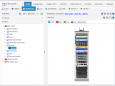
NetZoom v.15
NetZoom is a software application for tracking and managing assets in small to medium size data centers, server rooms and IT rooms. In NetZoom users can model data center floor layouts, manage rack elevations and servers and track assets.
TestDNA v.1.0
Create FCS histograms with this program. TestDNA help you generate FCS histograms of cell cycle data with known component values.

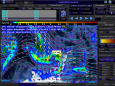
WeatherStudio v.2
WeatherStudio combines a vast array of weather products valuable to storm chasers, meteorologists, mariners, first responders, and home users all on a hardware-accelerated, GIS enabled map.
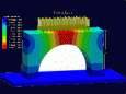
Stoner Engineering Software v.4 59
SES is for geologists who are dissatisfied with drafting-tool methods of geosteering. SES is 3D technical geosteering software that makes wellbore stratigraphic tracking quick-n-easy, accurate, and easily shared.
I-TRAC v.3.01
This software helps plan, monitor and control management agendas. By watching dynamic views instead of static data tables,
WOBD v.1 5
wOBD - simple yet comprehensive, accurate and reliable Windows software for ELM 32x based OBD2 converters.